An historic collection
The 3D scale model of Saint-Omer comes from a collection of models dating back to 1668 during the reign of Louis XIV. The king could monitor the fortification work being undertaken by his military engineers from far away. It was also a prestigious way of representing the kingdom’s fortifications. They were displayed in 1700 at Le Louvre and then at Les Invalides from 1777 onwards. The models stopped being made when pentagon-shaped fortifications ceased to be built after the Franco-Prussian War of 1870. The collection, listed in 1927, is comprised of 260 3D scale models. It is conserved by the “Musée des plans-reliefs” (Military Model Museum) opened at Les Invalides in 1943.
Specific technique
The models are made using precise plans. They are made on a scale of 1 foot to 100 toises in other words approximately 1:600 i.e. one centimetre represents six metres. Due to their size they are designed in a workshop on several tables which are then put together. The main materials are wood, papier-mâché for the raised sections and buildings, and silk and paint for fields, trees and water. They are consequently fragile objects that have sometimes suffered from the torment of time in spite of being restored.
3D model of Saint-Omer
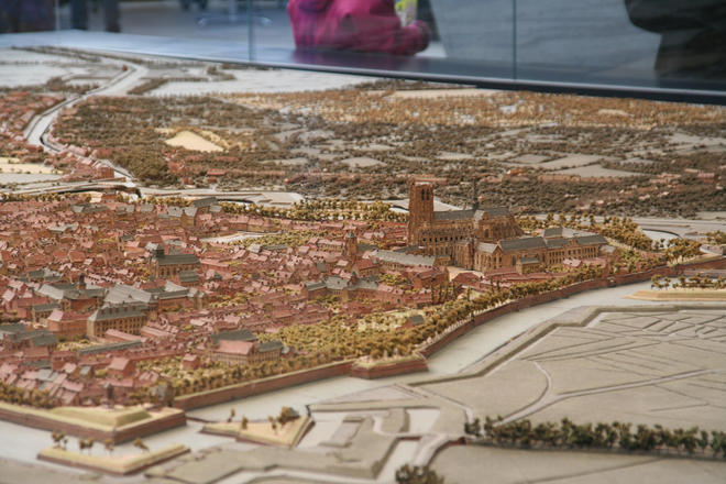
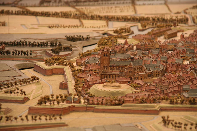
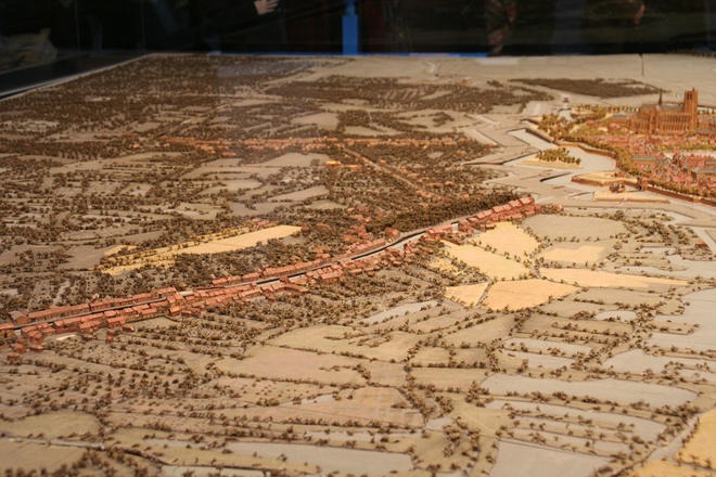
The model of Saint-Omer was designed in 1758 by an engineer called Larcher d’Aubencourt. It represents the fortified town and the surrounding area: the districts, part of the marshland, Arques, Blendecques, Longuenesse, Saint-Martin-au-Laërt. Made up of 35 tables put together, it is 10.65 metres long and 5.74 metres wide thus covering 61m2 in all. It proved impossible to display it in the Palais des Beaux-arts de Lille, like the models of the other fortified towns in northern France. It is kept in storage in the “Musée des Plans-Reliefs” (Military Model Museum) in Paris. 3D digitizing enables you to discover it. We decided to display it as it is today and as close to reality as possible. It is consequently quite normal to see some damaged walls (Alderman Hall) and notice some buildings missing (Jesuits chapel, Albret barracks). As some tables are still waiting to be restored and have dust removed by laser, they have a rather sombre appearance. Lastly, despite its intricate detail, it was actually designed to be seen from a distance. However, digitization allows you to get very close to it. The 3D scale model provides a unique image of our area in the middle of the 18th century and enables us to understand its development.
Discover the 3D scale model
1 - Download and install the software :
2 - Download this 3D module file and launch it with the software :
Découvrir le plan relief en 3D
Browsing the 3D scale model of the town of Saint-Omer (actual scale: 1:600)
With the mouse :
- Left button pressed down: moving the mouse enables you to move the model
- Right button pressed down (or scroll wheel): moving up and down enables you to zoom in on the model
- Middle button pressed down: moving the mouse enables you to rotate the model
- Double-click on one of the buttons: focuses on the model by using the mouse pointer
Keyboard :
- Right and left arrow keys: moves the model
- Up and down arrow keys: overhead view of the model
- Touches Alt + Arrows keys : rotates the model
Keyboard shortcuts :
- Home key : returns to initial position
- Tab key: enables/disables the stereo mode (anaglyph by default)
- F11 key : enables/disables full screen mode


